Cities · Puzzle #2 · Thursday, October 1
Cities: the board
Eight items, eight categories, one place each. Here is the board with every figure and where it comes from, and the best way to place them. Play today's Cities.
The categories
- Rainy: 1 pt per 8 inches of rain a year
- Down south: 10 pts if south of the equator
- Far from the equator: 1 pt per 6° north or south
- High altitude: 1 pt per 500 ft above sea level
- Packed in: 1 pt per doubling over 40 people per square mile
- Capital city: 10 pts if its country's capital
- Hot spot: 1 pt per 5°F of yearly average over 30°F
- Sprawl: 1 pt per doubling over 2 square miles
The best board
- Amsterdam in Far from the equator: lies 52° from the equator (8.7)
- Lahore in Hot spot: averages 78°F over the year (9.7)
- Shanghai in Sprawl: covers 2,448 square miles (10.0)
- Tehran in Capital city: is its country's capital (10.0)
- Medellín in Rainy: gets 83 inches of rain a year (10.0)
- Thimphu in High altitude: sits 7,615 ft above sea level (10.0)
- Adelaide in Down south: is in the Southern Hemisphere (10.0)
- Geneva in Packed in: packs in 34,012 people per square mile (9.7)
The most this board could score: 78.1 of 80.
The lineup, figure by figure
Amsterdam
Netherlands
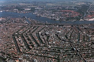
Photo: Amsterdam Municipal Department for the Preservation and Restoration of Historic Buildings and Sites (bMA). The author is BMZ (Bureau Monumentenzorg). Original uploader was Siebrand at nl.wikipedia Later version(s) were uploaded by Eriksw at nl.wikipedia., Attribution - Rainy
- gets 33 inches of rain a year (4.1) Source: Wikipedia
- Down south
- is in the Northern Hemisphere (0.0) Source: Wikipedia
- Far from the equator
- lies 52° from the equator (8.7) Source: Wikipedia
- High altitude
- sits -7 ft above sea level (0.0) Source: Wikidata Q727, P2044
- Packed in
- packs in 10,898 people per square mile (8.1) Source: Wikipedia
- Capital city
- is its country's capital (10.0) Source: Wikipedia
- Hot spot
- averages 51°F over the year (4.2) Source: Wikipedia
- Sprawl
- covers 85 square miles (5.4) Source: Wikidata Q727, P2046
Lahore
Pakistan
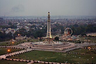
Photo: Lime.adeel, CC BY-SA 3.0 - Rainy
- gets 23 inches of rain a year (2.9) Source: Wikipedia
- Down south
- is in the Northern Hemisphere (0.0) Source: Wikipedia
- Far from the equator
- lies 32° from the equator (5.3) Source: Wikipedia
- High altitude
- sits 712 ft above sea level (1.4) Source: Wikidata Q11739, P2044
- Packed in
- packs in 16,262 people per square mile (8.7) Source: Wikipedia
- Capital city
- isn't its country's capital (0.0) Source: Wikipedia
- Hot spot
- averages 78°F over the year (9.7) Source: Wikipedia
- Sprawl
- covers 684 square miles (8.4) Source: Wikidata Q11739, P2046
Shanghai
China
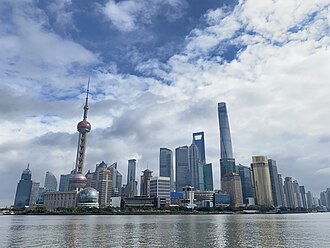
Photo: MasaneMiyaPA, CC BY-SA 4.0 - Rainy
- gets 51 inches of rain a year (6.3) Source: Wikipedia
- Down south
- is in the Northern Hemisphere (0.0) Source: Wikipedia
- Far from the equator
- lies 31° from the equator (5.2) Source: Wikipedia
- High altitude
- sits 13 ft above sea level (0.0) Source: Wikidata Q8686, P2044
- Packed in
- packs in 9,865 people per square mile (7.9) Source: Wikipedia
- Capital city
- isn't its country's capital (0.0) Source: Wikipedia
- Hot spot
- averages 62°F over the year (6.5) Source: Wikipedia
- Sprawl
- covers 2,448 square miles (10.0) Source: Wikidata Q8686, P2046
Tehran
Iran
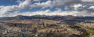
Photo: Amir Pashaei, CC BY-SA 4.0 - Rainy
- gets 12 inches of rain a year (1.5) Source: Wikipedia
- Down south
- is in the Northern Hemisphere (0.0) Source: Wikipedia
- Far from the equator
- lies 36° from the equator (5.9) Source: Wikipedia
- High altitude
- sits 3,868 ft above sea level (7.7) Source: Wikidata Q3616, P2044
- Packed in
- packs in 32,823 people per square mile (9.7) Source: Wikipedia
- Capital city
- is its country's capital (10.0) Source: Wikipedia
- Hot spot
- averages 62°F over the year (6.5) Source: Wikipedia
- Sprawl
- covers 265 square miles (7.0) Source: Wikidata Q3616, P2046
Medellín
Colombia
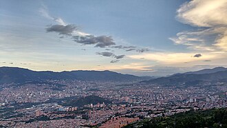
Photo: Luis90f, CC BY-SA 4.0 - Rainy
- gets 83 inches of rain a year (10.0) Source: Wikipedia
- Down south
- is in the Northern Hemisphere (0.0) Source: Wikipedia
- Far from the equator
- lies 6.3° from the equator (1.0) Source: Wikipedia
- High altitude
- sits 4,610 ft above sea level (9.2) Source: Wikidata Q48278, P2044
- Packed in
- packs in 17,206 people per square mile (8.7) Source: Wikipedia
- Capital city
- isn't its country's capital (0.0) Source: Wikipedia
- Hot spot
- averages 62°F over the year (6.3) Source: Wikipedia
- Sprawl
- covers 147 square miles (6.2) Source: Wikidata Q48278, P2046
Thimphu
Bhutan
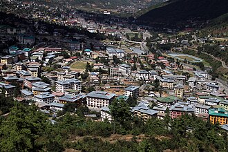
Photo: Gerd Eichmann, CC BY-SA 4.0 - Rainy
- gets 40 inches of rain a year (5.0) Source: Wikipedia
- Down south
- is in the Northern Hemisphere (0.0) Source: Wikipedia
- Far from the equator
- lies 27° from the equator (4.6) Source: Wikipedia
- High altitude
- sits 7,615 ft above sea level (10.0) Source: Wikidata Q9270, P2044
- Packed in
- packs in 10,988 people per square mile (8.1) Source: Wikipedia
- Capital city
- is its country's capital (10.0) Source: Wikipedia
- Hot spot
- averages 43°F over the year (2.6) Source: Wikipedia
- Sprawl
- covers 10 square miles (2.4) Source: Wikidata Q9270, P2046
Adelaide
South Australia, Australia
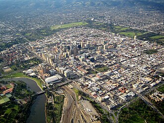
Photo: Photograph by Doug Barber, CC BY-SA 3.0 - Rainy
- gets 17 inches of rain a year (2.1) Source: Wikipedia
- Down south
- is in the Southern Hemisphere (10.0) Source: Wikipedia
- Far from the equator
- lies 35° from the equator (5.8) Source: Wikipedia
- High altitude
- sits 3 ft above sea level (0.0) Source: Wikidata Q5112, P2044
- Packed in
- packs in 2,591 people per square mile (6.0) Source: Wikipedia
- Capital city
- isn't its country's capital (0.0) Source: Wikipedia
- Hot spot
- averages 61°F over the year (6.1) Source: Wikipedia
- Sprawl
- covers 500 square miles (8.0) Source: Wikidata Q5112, P2046
Geneva
Switzerland
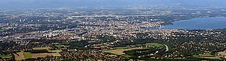
Photo: Yann (talk), CC BY-SA 4.0 - Rainy
- gets 44 inches of rain a year (5.5) Source: Wikipedia
- Down south
- is in the Northern Hemisphere (0.0) Source: Wikipedia
- Far from the equator
- lies 46° from the equator (7.7) Source: Wikipedia
- High altitude
- sits 1,329 ft above sea level (2.7) Source: Copernicus GLO-90, via Open-Meteo
- Packed in
- packs in 34,012 people per square mile (9.7) Source: Wikipedia
- Capital city
- isn't its country's capital (0.0) Source: Wikipedia
- Hot spot
- averages 48°F over the year (3.6) Source: Wikipedia
- Sprawl
- covers 6.1 square miles (1.6) Source: Wikidata Q71, P2046

_evening.jpg)


